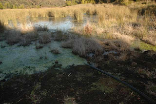
The lakes have been very high in the past, and today, the water is approximately 60 metres distant (horizontally) from the original formed edges of the two main public access areas of the Thirlmere Lakes, and that means that the levels are approximately 3 metres below maximum. What water is present is a mere "drop in the bucket" compared to what was once there.
However, there has definitely been a rise in water levels in Thirlmere Lakes in recent months.
The cynic in me immediately assumes this is because of the attention which has been paid recently to the "drying up" of Thirlmere Lakes. I actually hope that is the case, because that could only mean one thing - namely that variations in the water levels are related to human activity, because there has not been any significant increase in rainfall in the region in recent months (since I last posted about Thirlmere Lakes). It is acknowledged by the SCA that the "drought" in the Catchment ended several years ago.
My question would simply be has there been any variation of water pumped from Tahmoor Colliery in recent months?
 |
| Sand and some water in Lake Werri-Berri at Thirlmere Lakes 27 July 2012 |
Check out this previous posting for comparable photographs.
 |
| Sand and some water in Lake Werri-Berri at Thirlmere Lakes 27 July 2012 |
 |
| At waters edge. Lake Couridjah, Thirlmere Lakes 27 July 2012 |
d |
| Marker visible on far side of Lake Couridjah |
 |
| Zoomed view from waters edge to the formed bank of the Lake Couridjah Footings of the old pier are still exposed |
 |
| Wider view from waters edge to the formed bank of the Lake Couridjah Picnic shelter in car park visible in distance. |
 |
| Lake Nerrigorang, the last lake in the chain of Thirlmere Lakes |
 |
| An old foot path leading out into Lake Nerrigorang, the last lake in the chain of Thirlmere Lakes |
 |
| A water level marker has been encroached up on by the rising waters in Lake Nerrigorang. |
 |
| Close-up of marker in Lake Nerrigorang |
 |
| I am touching the marker at waters edge Lake Nerrigorang, Thirlmere Lakes 27 July 2012 |
 |
| Water seeping through the peat in Lake Nerrigorang near a survey peg 27 July 2012 |
 |
| The survey peg on 27 July 2012 |
 |
| Marked peg Lake Nerrigorang 27 July 2012 |
No doubt we will hear more about this issue in the future.

1 comment:
Just a big thanks to the local mines for ruining our beautiful lakes.
I f you tell me this is from natural causes, karma is going to bite you on the arse.
NO MORE MINING.
Post a Comment