Christmas Bells

Christmas Bells
Christmas Bells - Blandfordia nobilis
Showing posts with label Badgerys Lookout. Show all posts

Sunday, April 08, 2012

Bungonia and Long Point, and Badgery's Lookout

These three areas are closely located - but contain noticeably different habitats.

They all are overlooking the Upper Shoalhaven River.
Bungonia is (famously) located on a Limestone reef, which has eroded severely (such is the nature of Limestone). The surrounding geology is mostly sandstone (which has not eroded as much). But even my untrained eye can detect variations in the soil and stone colour and consistency as one moves from area to area within the Bungonia State Conservation Area. The famous gorge is between the "Lookdown" and the Bungonia Mine pit.
Long Point is next, and I must stress that I am not a geologist, so I will simply state that to my untutored eyes, the rocks there appear to be more shale-like. But it has higher moisture retention characteristics, seemingly, judging by the plant growth in the area.
Badgery's Lookout is the next accessible point along the Upper Shoalhaven River. It has a different geology too. I recognise that, mostly because of the different trees and specifically, by the different Orchids which grow there.
But here, at least I can quote from the experts who contributed to the Mulwaree Shire Community Heritage Study, 2002 - 2004
  • "The sandstone cliff of the marine Snapper Point Formation [a body of rock] is adjacent to the lookout, while further east, a cliff with three distinct levels can be seen, a lower sandstone cliff [Snapper Point Formation], a plateau in the middle [Wandrawandrian Siltstone] and an upper sandstone cliff [Nowra Sandstone]. A peneplained surface [a nearly featureless, gently undulating land surface of considerable area] is broken by large rock formations [phyllites and graptolitic shales] which form the base of the sedimentary sequence described above. The headland itself is capped with basalt [a volcanic rock] and petrified ancient soil."
In the most simplistic terms, although these three lookout points are all similarly high over the Shoalhaven River, and give superficially similar views of the River Gorge, and are little more than 6 kilometres apart (directly) in fact they reveal the immensely complicated geology of the entire region.

At Long Point Lookout there is an old stone toilet block hidden away, nearly out of sight in a patch of dense trees and shrubbery. Around that area one finds masses of leaves of Acianthus and Chiloglottis.
As often happens with both those species, there are relatively few flowers to be seen.

Acianthus exsertus
Chiloglottis seminuda
 On the Lookout edge of Long Point, we found this nearly finished flower of a Diplodium. From the extremely fine tip of the "galea" (hood) and the position of the points, I believe this is likely to be Diplodium revolutum which we had found an hour before on the dry rocky track at Bungonia.
Possibly Diplodium revolutum
Sinus and Labellum of that possible Diplodium revolutum
This plant of Diplodium obtusum was the only flower of this species which we found at Long Point. We had seen many of these plants on a previous visit there, on February 24 It is interesting to see the same species still flowering in the same group of plants, some six weeks later.
Diplodium obtusum

 At Badgery's Lookout, we found Diplodium reflexum
Rear view of Diplodium reflexum

Front-on view of Diplodium reflexum
its hows a much blunter tip than the
related Diplodium revolutum.
And what is this?
This plant is obviously a Pterostylis Greenhood,
It has no stem leaves, nor did it have basal rosettes.
Also the plant appeared to have been nibbled by something.
But what? The area is so dry and stony 
it is hardly likely to be snail damage.
And Wallabies and Wombats normally chew off the entire flower.
The points, the tip of the hood and even the labellum
had all been "shaved back".
Thus nearly all the diagnostic characteristics had disappeared.
We end with a puzzle.
Is it Pterostylis curta?
That seems unlikely given the dry location
and the lack of basal rosette of leaves.

Friday, February 24, 2012

A big day out at Tallong

Tallong is home to the Tallong Midge Orchid, (Corunastylis plumosa). This Corunastylis is endemic to the district, and likes to grow on mossy rock shelves. It grows under or close to the Violet Kunzea (Kunzea parvifolia) and Common Fringe-myrtle (Calytrix tetragona) shrubbery which dominates these generally dry and exposed rock mounds.This rare plant is listed as Endangered on the EPBC Act lists.
)
Corunastylis plumosa in situ
growing out of moist moss shelf.

Corunastylis plumosa at Tallong
Click to enlarge to see details.

 There were a few other species of Midge Orchids in flower today, at Tallong.
Corunastylis apostasioides (typically barely open)
Click to enlarge.
 We found a giant specimen of this species. 
The flowers had just finished.
Alan Stephenson measured it at 48 cm high
(The measurement is hard to read from above).
I do know it came up to my knee height.


Corunastylis fimbriata at Tallong

Corunastylis fimbriata - the Labellums flap in the breeze

Corunastylis simulans at Tallong
This plant also has a motile labellum
It is a rich purple colour.
We left the main Tallong area and went to the stunning Lookouts (and good Orchid habitats) of the district, overlooking the Upper Reaches of the Shoalhaven River.

Firstly we went to Long Point Lookout. This stunning place gives you great views of "Horseshoe Bend" in the Shoalhaven River.
Long Point Lookout view to the right (up-river)
Shoalhaven River.

Long Point Lookout view, looking straight down the river
Shoalhaven River - from Long Point Lookout.

Diplodium obtusum at Long Point Lookout
Growing on steep slopes of loose rocks
makes Diplodium obtusum hard to photograph.
Close-up of Diplodium obtusum
Note the "rolled edge" on the "sinus"
The labellum is still "set" but is hard to see.
Click to enlarge.
Diplodium obtusum rosettes forming
It is interesting to see so many  new plants forming up.
Presumably getting ready for next season.
A very large brown beetle seen at Long Point Lookout
 Then we drove to the next lookout. Badgery's Lookout is quite famous in geological circles because of the way one can look into the ancient past to see how the land has been formed.
  • The sandstone cliff of the marine Snapper Point Formation [a body of rock] is adjacent to the lookout, while further east, a cliff with three distinct levels can be seen, a lower sandstone cliff [Snapper Point Formation], a plateau in the middle [Wandrawandrian Siltstone] and an upper sandstone cliff [Nowra Sandstone]. [Mulwaree Shire Community Heritage Study, 2002 - 2004 - P. 20]
Shoalhaven River seen from Badgery's Lookout
I was surprised to see "Cycads" or "Burrawangs" growing on the steep scree slope opposite and to the left from Badgery's Lookout. They were not across the main valley of the Shoalhaven, but across a gully to the east from the lookout. The reason I was surprised is that I normally associate these plants with deep sandy soils. But after checking PlantNET. there is only one species list anywhere near this area, and that is Macrozamia communis.
Cycads on rocky scree slope - from Badgery's Lookout
View toward Bungonia from Badgery Lookout
Bungonia mine from Badgery's Lookout
This is a terrible scar on the landscape,
but only a few visitors to Badgery's Lookout see this view.

One of the interesting things about these two lookout, quite close, and overlooking the same river, is the different species of plants found at these two locations. Presumably there are minor changes in geology between them, which influence the plants which feel comfortable growing in the two different soil types.

In this case, we find Diplodium reflexum growing at Badgery's Lookout, and not Dipl. obtusum. We found such good displays of these Orchids, that even though both Alan and I knew they grew here, and had seen them in previous years, we both felt that this was the best season for these plants which we had ever encountered.

Long pointed nose of Diplodium reflexum
Close-up of Diplodium reflexum
We found many "groups" of these plants. One loose group had 8 plants in it, but this tight cluster was better for me to photograph. They were in terrific form and condition. There were obvious signs of recent heavy rain in the district, which has presumably helped them bring on flowering in such profusion.
Diplodium reflexum - four fine plants growing together.

An even better cluster of Diplodium reflexum
Never knowing "When to say When", we continued back towards Fitzroy Falls and then we took a divergence to Meryla Pass (the head of Griffins Fire Trail). Alan is familiar with the bottom end of that track, in Kangaroo Valley, but had never been to the top.
I took him down several hundred metres along the Griffins FT, to see an exposed seam of coal there. Of course we found Orchids as well. Chiloglottis reflexa and Alan spotted a number of plants of Cymbidium suave
At this point, although I love the views along that road, I was in need of "Calling it a Day".

But then I came home, had a bite to eat, and sat down and took 5 hours to Blog about it, didn't I?
 
But I can sleep well, now having found a rare and endangered plant (the Tallong Midge Orchid), and the very best display of Diplodium reflexum which either Alan or I had ever seen.

Sunday, August 31, 2008

Upper Shoalhaven Valley

North-east of Marulan, near Tallong, the Shoalhaven River cuts through some very complicated geological formations - of limestone (at Bungonia), then metamorphic rocks at Longpoint Lookout, then it heads off into sandstone country, from just past Badgery's Lookout. These lookouts are just on the edge of the western end of the Morton National Park.This huge ugly scar is the Limestone Quarry at Bungonia. This view is seen from Badgery's Lookout, which is actually further away from the quarry than Longpoint Lookout. The machinery and sheds are clearly visible on the right hand side. This is what the Bungonia Quarry looks like from the air.
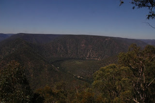
This is the sight you see from Longpoint Lookout. The Shoalhaven River flows through two huge horseshoe bends, as it flows from the right (west) to left. It is just about to enter the classic Shoalhaven Sandstone country - with near vertical clifflines, such as one sees at Fitzroy Falls. You can see the beginning of such formations on the left of the photo - whereas, in the centre, the hills are steelpy sloping, but not with cliffs - indicating their different metamorphic geology to which I referred. The Limestone geology upon which the Bungonia caves are founded is actually just a couple of kilometres away, but it was out of sight from this point. I could hear the huge machines operating, while at this lookout. It is that close. So, again, that confirms the complex mixture of geological formations in this small area. I had written a reference to the "mighty" Shoalhaven River, but there is very little of it, in truth. But by Australian standards, it is a mighty river valley.
You will realise that I did not come down to this wild and inaccessible spot, just for the view. I was checking out this area for Orchids, of course. I only found Nodding Greenhoods (Pterostylis nutans) in flower, unfortunately.

There were a few plants, some with advanced buds. This plant sometimes forms great colonies, but, alas, not here. It is probably not wet enough for that to happen. This section of the Shoalhaven Valley is in a low rainfall area, and the geology is very rocky and the slopes are very steep - so any rain which does fall runs off almost straight away.
There were some fully mature flowers, such as this one, with the pollinia clearly visible inside the "hood" (galea) of the flower.Another Orchid growing here, but not in flower, is the Dockrillia striolatum (a.k.a. Dendrobium striolatum). In this region, this plant grows predominantly on rocks. The case here, where the roots are within a narrow crack in the rock is a typical manner of growth of this plant - on a vertical rock face. This plant has triangular shaped leaves (in cross section) strangely reminiscent of a "Pigface". The leaves are thickly coated in order to reduce transpiration and to maximise water conservation - which when growing on a vertical rock face, has to be a priority.Here is a photo of a female Grey Kangaroo, with a small joey poking its head out from her pouch, and a youngster (presumably from last year) still at heel with her. These Kangaroos were living on the relatively poor farm lands several kilomentres from the Longpoint Lookout.