Christmas Bells

Christmas Bells
Christmas Bells - Blandfordia nobilis
Showing posts with label Hindmarsh_Lookout. Show all posts

Monday, January 19, 2015

Hindmarsh history re-lived


Yesterday, my friend Gordon accepted a suggestion from me to help Dr Michael Hindmarsh, from Gerringong. go to the bottom of Belmore Falls. I had met Michael at the Kiama Community Recognition Awards ceremony on 12 December 2014. He happened to mention that he wanted to find a particular tree below Belmore Falls and I said that I could recommend an excellent Bushwalking guide. I had Gordon in mind, and I put them in contact with eachother.

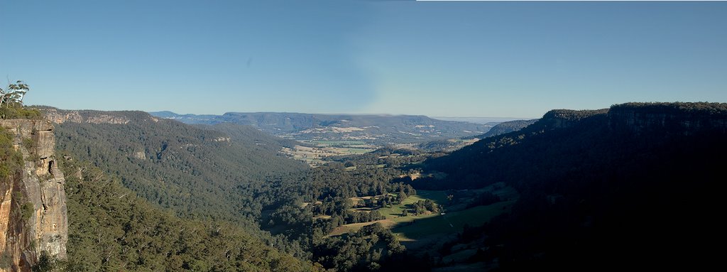
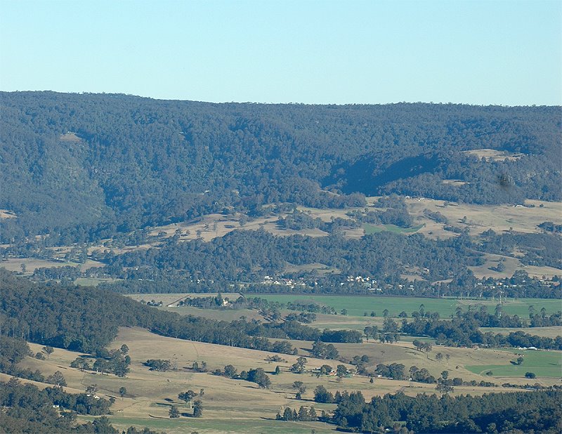
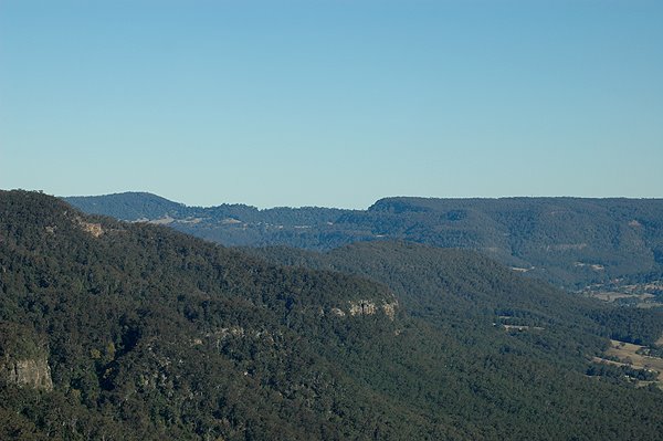
Naturally enough, their starting-off point was Hindmarsh Lookout. So already you can see there is a lot of history involved.
Gordon at Hindmarsh Lookout
As best I can remember, Michael is a 5th generation descendant of the Hindmarsh family who were amongst the first settler in Robertson. These people walked up from the Gerringong area, via Hoddle's Track, up past Saddleback Mtn and up onto the Barrengrounds Plateau, and on towards the basalt capped hills of Robertson. 

The basalt soil was what these pioneer settlers were seeking to claim under the Robertson Land Act of 1861. More history involved. It was Land Reform, pure and simple. The Squatters hated John Robertson for this breaking of their monopoly on land ownership.
"History
In 1861, the powerful Premier of New South Wales, John Robertson, was determined to break the long-established monopoly of the squatter-pastoralists in land-holding in the colony. He forced two Acts through the Parliament, opening up free selection of Crown land by permitting any person to select up to 320 acres, on the condition of paying a deposit of one-quarter of the purchase price after survey, and of living on the land for three years.

Robertson intended to give poorer purchasers access to land and to increase farming and agricultural development in New South Wales. Great conflicts between the squatters and the selectors ensued, and corruption and scheming in acquiring land became rife."
Source: 
Crown Lands Acts 1861 (NSW) 

Anyway, after their bushwalk to the Barrengarry Creek, below Belmore Falls, Michael and Gordon came back to Gordon's place, where I was awaiting their arrival. 

Lulu was with me, of course, and she really likes Gordon. But she took a shine to Michael too.
In particular, what was really fascinating her was the bloody leech bites on Michael's legs.


She set about cleaning Michael's legs for him.

 This scene reminded me of something I had learnt in Bible Studies, namely Lazarus (the leper, not the one who was raised from the dead) who was licked by stray dogs, which cleaned his wounds.
(Luke 16:19-31)
Dogs showed compassion
toward Lazarus the beggar,
even when people did not.  
Public domain
The dogs would have promoted healing by licking Lazarus’ wounds, since dog saliva contains the antibacterial enzyme lysozyme. Lysozyme is a natural form of protection from gram-positive pathogens like Bacillus and Streptococcus. Being a Veterinarian by profession, Michael would have understood this healing process far better than I did from my rusty old Bible Studies.

Friday, October 14, 2011

Grass Trees flower well after fire.

These Grass Trees (Xanthorrhoea australis) are in flower now. The flower stem and scape totalled more than 3.5 metres high. It is very impressive in flower.

Grass Trees (Xanthorrhoea australis)
They are in the Belmore Falls part of the Morton National Park, near a toilet block close to Hindmarsh Lookout. This area was burnt out about 18 months ago by vandals who burnt out a car there. The Grass Trees in that area were all burnt. Suddenly, these plants are now nearly all in flower (but only the ones which were burnt).
I have previously written about flowering Grass Trees in the Sandstone forests around Robertson, because their flowering is a relatively rare event. 

You can read a general description of the Xanthorrhoea genus on Wikipedia 
The exact determination of the different species in the Xanthorrhoea genus is notoriously difficult. In general, most botanists use a ration of the length of the flower stem to the length of the flower "scape" (the bit with the dark hairs and the flowers embedded in it). you can refer to detailed species notes on PlantNET here.

I do know we have many short-stemmed Grass Trees in the upland swamps of Butler's Swamps and out on the Barren Grounds. They look very different, with no trunk at all, and a much finer flower spike and scape than this handsome beast.
Leaves of Grass Tree and stem base
Base of Grass Tree - I can just grip around the stem

Top of Grass Tree stem.


Masses of flower on the stem of Grass Tree
A single flower of a Grass Tree (Xanthorrhoea australis)
This next image shows why Honeyeaters and bees are attracted to Grass Trees.
I tasted this sticky bead of nectar, and it was very pleasant. The Aboriginal people are reported to have soaked flower stems in water to gather  a sweet drink. They also use the resin from the base of the trunk for a kind of strong glue.
A bead of sweet nectar on the flower of a Grass Tree
The fact that Grass Trees are triggered into flowering is well recorded, but there is a spectacular photo of this on Earth Sciences Picture of the Day from 1 May 2007. It is well worth the look.

I have received a comment from "Le Loup", an expert in bush craft and self-sufficiency. I hope that's a fair interpretation of his skills.
You can judge for yourself at "A Woodrunner's Diary"
Le Loup has told me:
The inner core of the flower stem can be used as tinder for making fire with flint, steel & tinderbox. The natives used/use it to carry fire from one place to another. The lower foliage can often be found to be dry under the outer layers & it makes good kindling. This plant grows in every state of Australia.
The flower stem can also be used for making a hand fire drill & for making the bit & fireboard of a fire-bow.
Regards.
http://woodsrunnersdiary.blogspot.com/

Friday, February 01, 2008

Hindmarsh Lookout - Storms shape Kangaroo Valley

Yesterday I wrote about the big storm which blew up from Macquarie Pass to Sydney. Prior to that storm, I had been down at Hindmarsh Lookout, near Belmore Falls, and found a wall of water closing off the normal view of Kangaroo Valley. To see what I mean about the Barrengarry Creek Valley being "closed off", you need to compare this image with the two photos below.
It was really eerie, as the light was altered (from normal) because the view was foreshortened. And the outside of the wall of water was still in sunlight, so the brightness was increased. It changed dramatically when the storm arrived, of course. Suddenly everything went dark.

This is the normal view from this Lookout. In fact, I have previously written about the good view one normally sees from this point. This is a panoramic image, so click on the image to enlarge the view. Here is the full distant view (zoomed) of the village of Kangaroo Valley, which one can normally see from this same lookout.The difference in these views is all to do with one thing - the weather. Storms change the light (for a photographer). But they also produce the rain and water which has shaped this valley over millions of years.

Storms really do transform the landscape in the shortest and longest sense of time of which our human minds can conceive.

Wednesday, August 08, 2007

Back to Bushwalking

Today, Ian Archer led a group of walkers along the plateau at the end of Wallaby Hill road, then out to the top of Hindmarsh Pass, and then down into the Kangaroo Valley below.

It was a very pleasant walk, the more so for me as I had wanted to explore that area for some time.

I have been aware for some time, that when looking towards the Kangaroo Valley from Hindmarsh Lookout (near Belmore Falls) there is a large plateau which protrudes out in front of this lookout point, from the left. From my memory of the map I think it was referred to as the Yeola State Forest, but when I had sought to go to this area previously, it appeared it was closed off, by private property. Today I was shown that in fact, it is publicly accessible. A track leads to a section of the Morton National Park (which exists in many sections bordering the Shoalhaven Valley (which of course, includes the Kangaroo Valley).


As you can see from the photo above, the plateau drops down on a slope, then there is a severe "wall" or cliff line, half way down the hill. Below that, it again drops down on a steep slope to the valley floor below.

Towering above the tree tops, one can just make out the tops of the cliffs.

We walked down the steep slopes, and eventually came out to farming land, and kept going down, down, down, until we eventually came to a group of cars. Our "rescue group" had pre-arranged to meet us in a convoy of vehicles, to drive us back around through Kangaroo Valley, and back up via Fitzroy Falls, to Robertson. Just as well. I was pretty worn out, and in need of "rescuing" with a cuppa, and a car to sit in, on the way home.

A very good walk, thanks to Ian and the "rescue committee", and the good company of fellow walkers.

Monday, July 10, 2006

The Nature of a good view

The best view of Kangaroo Valley which I know of (that is readily accessible) is from Hindmarsh Lookout, which is very close to Belmore Falls.

Click on the photo to enlarge this panoramic image.


Belmore Falls is the closest (to Robertson) of the local waterfalls. It is about 7 Km south of the village, down Belmore Falls Road.

This familiar view shows both the top waterfall (Belmore Falls proper) and a lower level waterfall.

The valley is filled with rainforest trees, and Lyrebirds were clearly heard calling from down in the valley bottom.

I am reliably informed by my bushwalking friends that there is a chain of six waterfalls at stages along the creek. Only the top two falls are visible from this lookout point.
*****

Near to the Belmore Falls lookout there is a totally different viewing point, right on the tip of the cliffline, where you look directly over Kangaroo Valley township. This is Hindmarsh Lookout.

From that lookout, one first notices the farmed areas in the "Upper Kangaroo Valley" (upper meaning "up-river" from Kangaroo Valley, in that sense). Then in the far end of the valley is the bright green area of the river flats, in Kangarooo Valley itself.

Just past the green paddocks in the bottom of the valley lies the village. The position of the village can be easily made out when the image is enlarged.

In fact the valley down which one is looking is the valley of Barrengarry Creek (which falls over the Belmore Falls). This valley has the same name as the Barrengarry Mountain, down which the main Kangaroo Valley Road passes, when one drives from Fitzroy Falls. However, the place name and this creek valley do not co-incide, as the mountain pass known as "Barrengarry Mountain" (on the main road into Kangaroo Valley) is no less than 2 valleys and 2 ridges away from here. Very confusing.

*****

I love this peaceful viewing point. On any day, in any weather, at any hour, there is always some point of interest which one can see, or appreciate, at this lookout point.

When I was looking at the view from here, I noticed that on the opposite ridge (to the east, i.e., front left, in this view) the cliffline is interrupted in one particular place.


It is places like that which the early European settlers in Kangaroo Valley would seek out, when looking for "passes" where they could develop tracks out of the Valley.

Some of these passes were vital to the economy of the early settlers, for these tracks were how they carried their produce to market, in Sydney, or to the early settlements on the highlands.

In the middle of this "close-up" image, there is an obvious creek line (with bright, light green coloured trees visible). This "close" may be enlarged by clicking on it.

Just to the right of that creek line, is what looks like a rock fall. That is where it might be possible to find a "pass" up to the plateau above. Almost certainly, this break in the cliff line would have been used as a "pass".

It is at that point where it might be possible to "pass" from the lower part of the valley to the top of the ridge, avoiding the sheer cliffs which otherwise form an impenetrable barrier along the hillsides.

As a matter of interest, the "different coloured trees" are, in fact, Red Cedar Trees, which are deciduous, and this images shows them changing colour, before losing their leaves. Red Cedar was a very important timber tree in the early days of European settlement in Kangaroo Valley.