Click here to see the map of yesterday's trip. When we met Lady Wakehurst Drive, we turned south, through to Otford, and then Stanwell Tops.
We stopped to capture the view as best I could,
in the late afternoon light.
You can see the same basic view on a clear day - here.
in the late afternoon light.
You can see the same basic view on a clear day - here.
 Regular readers will note that this is the opposite view of the Illawarra Coastline and Escarpment, from that taken a few days ago, at Lees Road Lookout, near Knights Hill.
Stanwell Tops is famous for its cliffs overlooking the Illawarra coast.
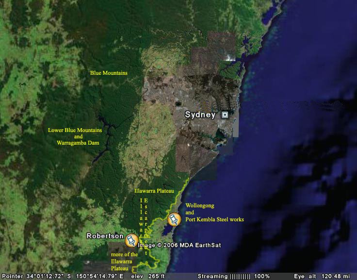
Here is another Google Map showing the viewing point
and it marks the vista of the photo above.
Click to enlarge, to read the notes on marked points.
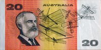
 Stanwell Tops is famous for Lawrence Hargrave's early experiment with flight - below a train of four box kites on 12 November 1894. Hargrave was suspended on a line below the lowest Box Kite, and he was tethered to the ground by a line held by an assistant. He rose 16 feet in the air.
Hargrave's design of the Box Kite eventually led the way for the Wright Brothers experiments in flight, in their biplane (a powered box kite, if you think of it in those terms), the Wright Flyer 1 (or Kitti Hawk).
Bald Hill at Stanwell Tops is also famous for Hang Gliding. It is a simple equation of the geographical feature of the proximity of the cliffs to the ocean. This means the place combines reliable sea breezes and uplifts owing to the cliffs and mountains behind them. It is perfect for non-powered flight - such as in Hang Gliders and Paragliding.
Nearly every point along this road seems to commemorate Lawrence Hargrave, in some way or other.
This is Zoe standing beside the Lawrence Hargrave Memorial
on Bald hill, Stanwell Tops. Photo taken in 2007.
on Bald hill, Stanwell Tops. Photo taken in 2007.
 Now this patch of the Illawarra Coast has another feature to boast about - the Sea Cliff Bridge.
Here is the Illawarra Coastline and Escarpment, as seen from Otford.
Looking south.
Looking south.
 "The Sea Cliff Bridge, opened in 2005, restored the connection between Clifton and Coalcliff, broken by frequent rock falls onto this section of the Lawrence Hargrave Drive. The bridge lies parallel to the former "coal cliffs" and offers scenic views of the cliffs, the sea, and surrounding coastline."
Here is a clearer shot, taken in 2007, from Bald Hill.

Here is a snapshot taken out the window, just on dark.
It shows the cliff line, as seen from the bridge.
It shows the cliff line, as seen from the bridge.
 You can see the cliffs from the free-standing bridge which is built on pylons which runs parallel to the coast. It was designed to overcome repeated blockages from landslips of the original road (the Lawrence Hargrave Drive)
Here is one of the official RTA aerial shots.
 Clearly the RTA is very proud of this bridge.
They have many images of the bridge under construction and completed.