What is this about the
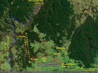
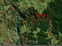
Kangaloon Aquifer? The Sydney Catchment Authority has drilled a series of “test bores” along the edge of the “Special Area” which basically is the reserved “water board” land below Tourist Road.
Photo: Upper Nepean catchment area - mixed Eucalypt forest, over sandstone, just a few metres from one of the test bore sites, beside Tourist Road. (Just outside the "special area").
Before Christmas the SCA was pumping from one bore about 1 Km north of the Macquarie River crossing on Tourist Road. They had a pipe running from this bore down to the Nepean River, with a small pump running continuously for a few weeks.
Well, last week, the Premier Mr Iemma announced that “two aquifers at the Nepean River, at Leonay, and at Kangaloon in the Southern Highlands, could be tapped to feed into Warragamba Dam.” He said: “The aquifers could supply two years of backup water until they were emptied. They would take five years to replenish” (SMH 8.2.06)
 This is a seriously dangerous threat to the ecological integrity of the Southern Highlands. Water is the key to the Robertson area. The Robertson Business Association uses the slogan “The green heart of the highlands”. The reality on which this is based could be threatened by the Premier’s plan.
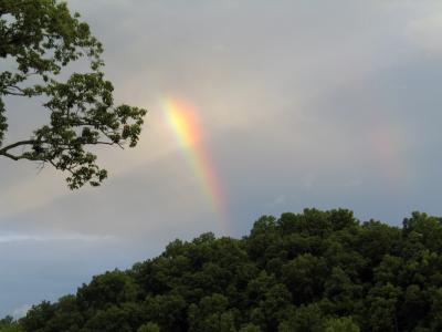
Photo: Rainbow after storm - Old Kangaloon Road, Kangaloon.
Robertson has the highest rainfall in the State. However, we do not just depend upon rainfall for the charactersitic green colours of the district. Partly it is soil. That is not threatened. However, the basalt soils are very porous. In fact they are very bad at holding water. So, heavy rain falling on porous soils means that the rain water drains into the ground very readily - and becomes “ground water”. Some of this water re-appears as “springs, soaks and oozes” to keep the local rivers running all year. (If that were not true, then the rivers would only run after rain. OK?) The rest of the ground water very slowly seeps through the underlying rock, into the rock substrate and forms deep “ground water” or what are known as “aquifers”.
Basalt rocks are generally very heavily fractured, because of their explosive volcanic origins, and the nature of the crystals which form the rock. So, as rocks go, they are relatively permeable. The basalt caps on which Robertson is located sit over a sandstone substrate. That rock is also somewhat permeable, as it is relatively soft, and relatively coarse-grained. It is also laid down in multiple layers, a fact which is immediately apparent when you examine any of the local cliff-faces, on the escarpment or in the spectacular gorges nearby (Carrington Falls, Belomore Falls, Fitzroy Falls).
So when ground water starts to permeate the sandstone, it might find a harder layer of rock (with, for example, more iron content than the layer above it). Then the water will either travel very slowly sideways, if the substrate has a slight tilt on it, (as the local sandstone plateaux have), or it can become permanently blocked at a particular level of impermeable rock. This is when it is called an “aquifer”. It is not, however, as Mr Iemma called it an “underground lake”. It is water trapped between the tiny grains of the rock, or in fissures of cracked rock. But it is water, none the less.
What happens to that water? Well, it is under pressure, from the weight of more water trying to soak down through the rock above it. So, where there is a fissure in the rocks above, it can come back up, as a spring, or a soak, or an ooze. Then it feeds a local creek, which becomes the Nepean River, which then drains into one of the catchment dams for Sydney.
In the meantime, these springs, which are all over the highlands, are absolutely critical to the health of the local environment, for not only do they they keep the creeks running, but before that, they moisten the soil, which is critical to keeping alive the vast numbers of old trees which make the area’s environment what it is. Everything depends upon the trees - insects, micro-organisms like fungi, bacteria, etc. Then, finally, the larger animals - the birds and the “animals”, and we humans and our farm animals, such as cattle.
There is one last link in the chain which I need to spell out. If the aquifer is drained, (even at a depth of 100 metres or more) it will disrupt the flow of all other ground water in the district. For springs come from the ground water - perhaps deep, or perhaps just from water which is blocked because there is already water underneath it.
Perhaps the simplest analogy I can use is to say that as the ground water has to flow slowly through tiny cracks in the rock, or to ooze between large particles within the rock itself, it behaves like vehicles blocked in a traffic jam. Cars at the back of the traffic jam, take diversions to avoid the blockage. They duck up side streets, they even go by long, circuitous routes, to avoid the blockage. However, eventually the blockage, when cleared, allows free flow of traffic again, and the cars pass easily through. So in the analogy, the cars ducking up the side streets, etc are like the water finding its way out of the sides of hills in springs and soaks.
But if the Aquifer is drained, it would be like clearing the blockage on the highway, and the water will have less resistance to drifting down ever lower, and lower in the rock. So there will be no need for the ground water to ooze up and out of the hills, as springs and soaks. So, the springs might dry up, the soaks might cease to ooze, and the green hills might dry up; the ancient trees might die. And the farmers’ bores, by which they water their cattle? Well they have already dropped some 10 metres over the last 10 years anyway (P 53 - Audit of the Sydney Drinking Water Catchment - December 2005). That drop has been caused by an increase in bore water usage, and from the drought. Imagine what would happen if Sydney Catchment Authority starts to drain the Aquifer, as the Premier has said they might do.
Try telling a dairy cow that it cannot get a drink for another 3 years, but, don’t worry, Daisy, Mr Iemma says it will be OK again after that.
On that point, water from the aquifiers has been tested, and shows that at about 200 metres depth, the water is roughly 1000 years old. (SMH Feb, 9, 2006 - “The myth of Sydney being drought-proofed”). So, do remember to tell “Daisy” she can have her drink in 998 years, not the 3 years Mr Iemma promised her, OK?
This is a proposal which threatens the very Nature of Robertson, for our green hills sit above the Kangaloon Aquifer, but all the ground water acts as a single entity. It makes no more sense to say it is OK to drain the aquifer, but the rest of the area will be OK, then to say that a flat tyre is only flat at the bottom.
This is a far more important issue than the proposal for a gaol. It does not just threated our comfortable "lifestyle" - this treatens the very Nature of Robertson.

