

This panoramic image is an amalgam of 7 photos, overlooking Robertson, from the north-west. This image spans about 150 degrees of the skyline, from due east (left) round to the south-west (on the right hand side).
The photos were taken from the tip of Trig Station Lane, in Kangaloon. This road runs from Kangaloon Road, back along the top of the local range, heading south-east, back towards Robertson. It is a narrow road, and a no-through-road, so if you drive out there, please take care, drive slowly, and respect the tranquil nature of this lovely area.
*****
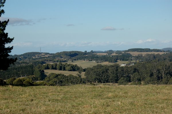 The view starts from almost due east (left) looking towards the Radio Tower, on Mackey's Lane, and spans across just to take in the distant Knight's Hill (with the TV antennas). Knight's Hill is on the very edge of the escarpment, overlooking Albion Park, with a clear view along the coast, north to Wollongong (which explains the TV towers).
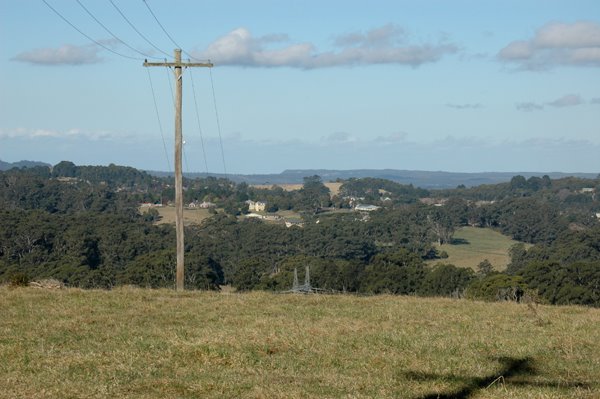 The next view is over the Showground area on the north of Robertson. The Showground is hidden behind a stand of large Eucalypt trees. You can clearly see some of the newer houses on May Street (west).
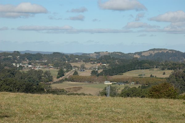 The third view is over the centre part of the Robertson village. The railway line runs a little way, alomost directly towards my vantage point on the hill, but it then turns to my right, and runs below the hill (outof sight below me).
Look at the end of the straight run of track. There is a large white square box (or sign) and two white posts. The white posts are the "Boom Gates", where the main road crosses the railway. So, Hoddle Street (a.k.a., the Illawarra Hwy) can be made out to run, to the left, behind some pine trees, then reappear, with a line of houses on either side. That is the start of Robertson's main street.
The large, rounded hill on the horizon, in the mid-distance is Bells Hill, one of the largest of the local basalt cap hills in the Robertson district. Bells Hill is used both for cattle grazing, and for growing potatoes. It is a typical Robertson Hill, with patches of rainforest on top, and cleared on the lower slopes for good farming land. The trees below the hill are tall Eucalypts.
 The fourth view takes in the southern slopes of Bells Hill, and then it shows a glimpse of the Sandstone Clifflines, in the Upper Kangaroo Valley area (down river from Carrington Falls). These cliffs are about 10 Kms away (directly).
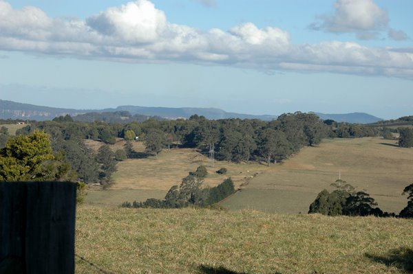 The fifth view looks over the rural areas south of Robertson, with distant glimpses of the higher parts of the sandstone plateau, either the Buddero Plateau, or perhaps the Barrengrounds area, and then, a separate mountain, which might be the top of Camberwarra Mountain, east from the village of Kangaroo Valley. These distant mountains are also on the edge of the coastal escarpment, with steep cliffs on the far side, running down to the coastal plain, around Berri and Nowra respectively.
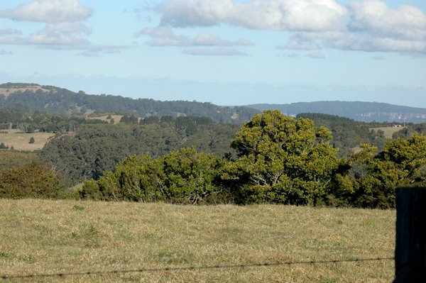
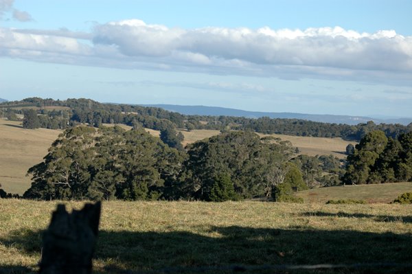 The sixth view is looking south-west. The ridge of hills on the left is along Pearson's Lane. The view looks towards the Fitzroy Falls area, and on to the lower Kangaroo Valley, near where it meets the Shoalhaven River valley. There are distant sandstone cliffs visible, on the south side of the Kangaroo River valley.
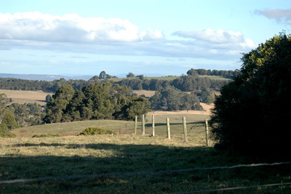 The final view, just a bit further south-west, shows the sandstone cliffs in the Kangaroo Valley still visible. Passing to the right, you run into local hill line which would take you across to the village of Burrawang. The local hills and trees do not allow you to see as far around as that.
*****
The physical nature of Robertson is determined by its basalt origins. The local rounded hills are all basalt caps. The basalt was laid down as a result of relatively recent volcanic activity (that is "relatively recent" in geological terms - some 60 to 70 million years ago). The volcanic activity brought the liquid basalt material from deep within the earth's crust.
It is easy to "read" from the local terrain, that the volcanic activity occurred by eruptions of material through the pre-existing layers of sandstone. That sandstone, (a much more ancient form of stone) is clearly visible in the plateau country which surrounds Robertson.
So, the local popular scenic places of Carrington Falls, Belmore Falls and Fitzroy Falls are all places where the sandstone plateau is exposed. It is eroded by rivers, creating these dramatic waterfalls. More importantly, from a geological point of view, the geological history of the region can be "read" while looking down into the exposed sides of these valleys.
1 comment:
I have been to the showgrounds for the Highland jollities.
Post a Comment