Christmas Bells

Christmas Bells
Christmas Bells - Blandfordia nobilis

Friday, June 30, 2006

The Nature of what is underneath Bell's Hill

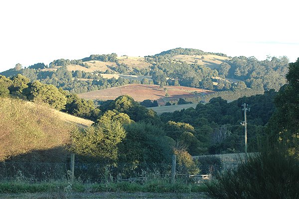
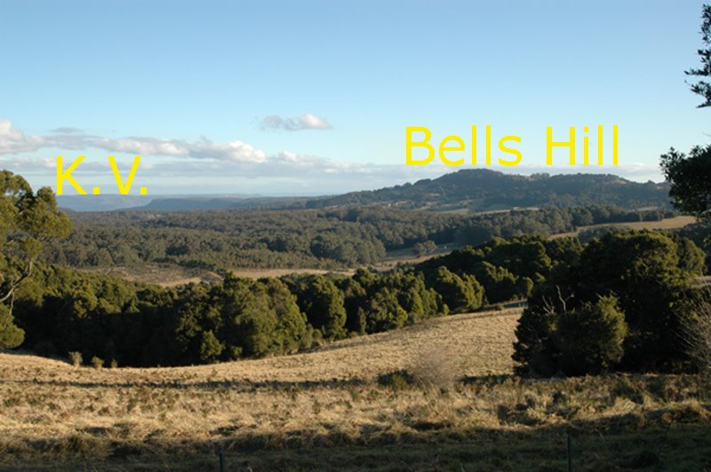
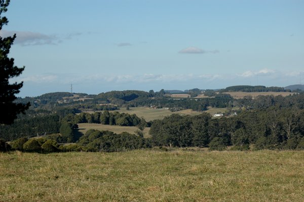
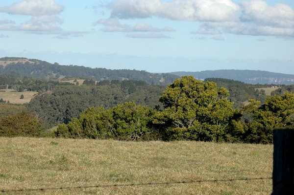
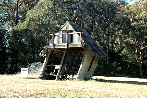
I asked the other day "what is underneath Robertson?". I gave the large scale answer, by showing medium distance photos of the district, showing both the plateau surrounding the Upper Kangaroo Valley, and Bell's Hill, rising above the plateau.

Here is what Bell's Hill looks like, from Robertson itself. This image was taken beside the Cheese Factory. You can clearly see the rich red basalt soil, having recently been ploughed, probably for next season's potato crop.

In my post of the other day, about the strata of stone under Robertson, I suggested one could draw a line across under Bell's Hill, at the level of the sandstone plateau - and deduce that the sandstone was continuous, right across, under Bell's Hill, and indeed the rest of Robertson. Today, I take the specific, or close up, approach.

If you drive to the bottom of Fountaindale Road (from Ranelagh House), you start on deep red basalt soil - the kind visible in the Bells Hill photo above. You are in a grove of rainforest trees.

As you start to flatten out onto the main area of farming land, you have dropped off the red soil, onto deep black soil. This soil is formed as the strata known as the Wianamatta Shale breaks down into soil - fine black soil.

This deep black soil makes good grazing country, and is mostly used these days for beef cattle production. Originally it was home to tall Eucalypt forest, and rainforest remnants.


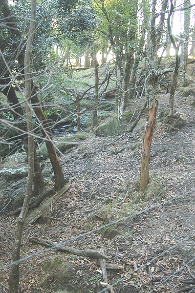
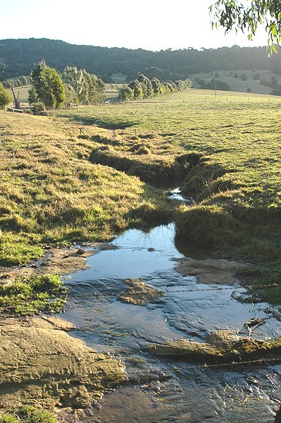
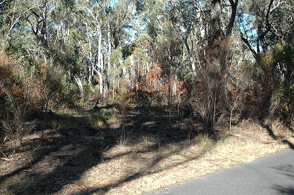
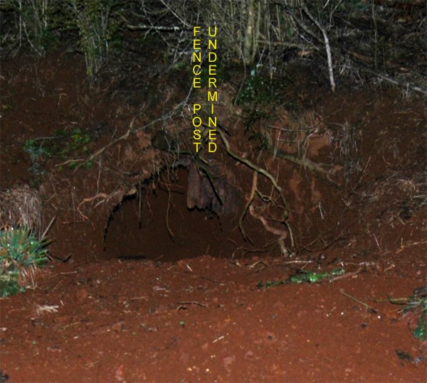
At the bottom end of Fountaindale Road, the road runs into the tall Eucalypt forest, and the soil changes to a sandy mixture. The depth of soil here is clearly visible in this creek side. It is probably about 30 metres deep.


This soil is a combination of black soil, washed down the hill, and the underlying sandy soils, derived from the sandstone base.


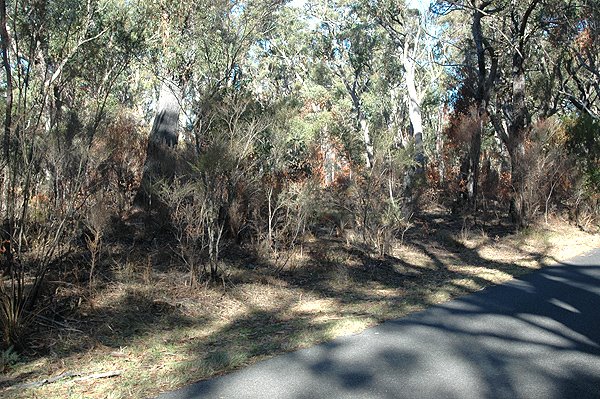
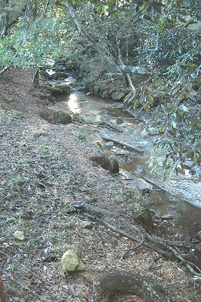
When you look closely at the bottom of the creek (it is a typical shallow stream, only a few inches deep) there is a flat base of exposed rock - a classic sandstone stream bed. And yet, this sandstone rock base is surrounded by the rich grazing country you see in the photos above and below.

Sandstone does not give you this rich farming country. You are looking at the lower strata of rock - the sandstone base. That underpins the more fertile black soil derived from the black shale, which is a separate deposit, in geological terms.


Out in the paddock, there is a small stream, just starting to erode through a much shallower layer of black soil, down to a sandstone rock shelf. Here the topsoil layer is less than 60cm (2 feet) thick. But the tell-tale flat shelf of sandstone rock is clearly visible.

The depth of the black soil is quite variable, obviously, if you compare this photo with the previous photos taken in the adjacent deep creekbed, just 50 metres away.

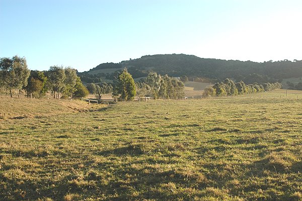
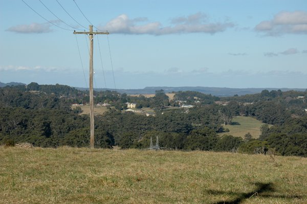
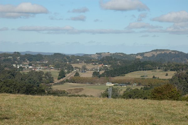
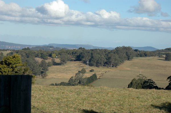
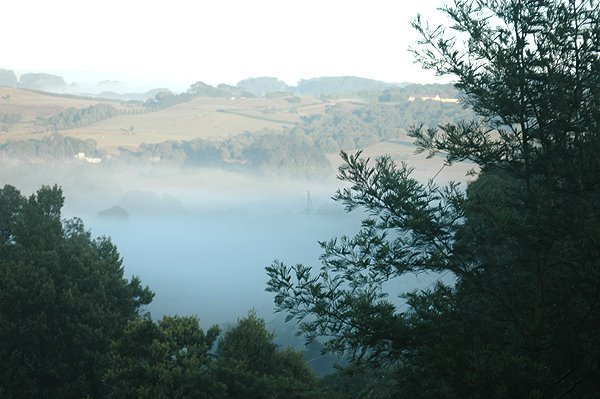
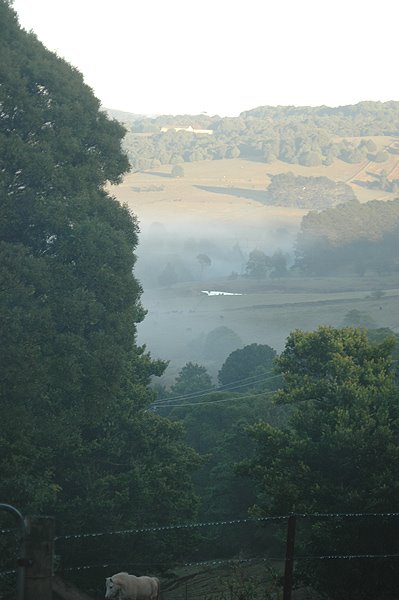
If you walk away from the deep creek and look up the hill, you see rolling paddocks, heading gradually up towards the mounded shape of Bell's Hill.

This image shows the complete picture - the exposed sandstone base, the black soil in the pasture land above, running back up the hill, to the slopes of Bell's Hill, less than 1 Km away.

So here it is: the sandstone strata, running directly under the basalt cap of Bell's Hill.


If you could get an equivalent picture elsewhere, under Robertson, it would be the same story. A continuous shelf of sandstone rock, underneath the basalt caps, and the rich red soil. And in between them, a layer of the Wianamatta Shale, which produces the black soil which is mostly is used for grazing country around Robertson.

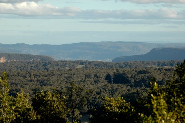
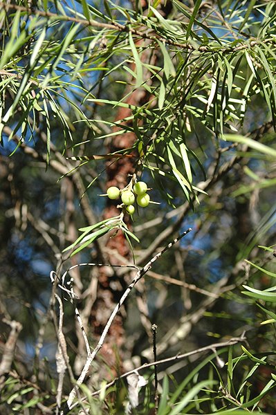
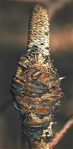
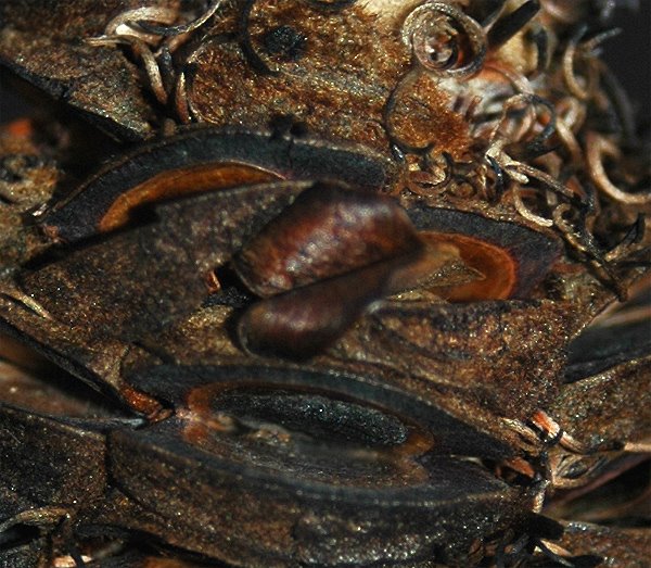
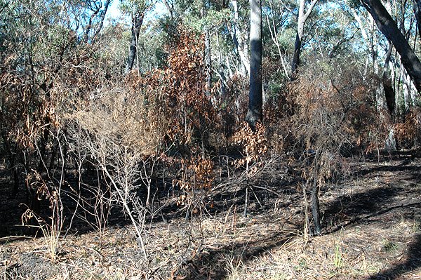
The same pattern is repeated as you drive south, down Belmore Falls Road, or going north, you drive down Kangaloon Road, and along Kirkland Road, in East Kangaloon. In each case, you run into sandstone scrub country, as you reach the level of the sandstone plateau (at Belmore Falls, and the Tourist Road).

So, rainforest (on the red basalt soil) gives way to tall Eucalypts or cleared grazing country (on the deep black soil), which in turn, give way to Sandstone-based Eucalypt and scrub country. It is these latter pieces of habitat which are mostly now preserved as National Parks, or the SCA "Special Area" along Tourist Road. The red and black soil areas have long ago been appropriated for farming country, unless they are too steep to farm - that fact explains the patches of remnant rainforest around Robertson - mostly on rocky hilltops, and in creek gullies.

So, the sandstone underpins the Nature of Robertson, and dominates the surrounding countryside.

Wednesday, June 28, 2006

The Nature of the Illawarra Plateau Dams

Here is a "Google Earth" image which shows the Illawarra Plateau. Specifically, it shows four dams on the Illawarra Plateau, north of Robertson, and west of Wollongong. (I have lightened this image, to make it easier to see the details.)

The main area of the Plateau clearly shows up as relatively undisturbed bushland. Some roads (shown by Google as thin yellow lines) circle the main patch of bushland which is known as the "Special Area", which is the protected area, controlled by the Sydney Catchment Authority. Hume Highway runs north from Mittagong. Two roads are shown coming out north and west from Wollongong, crossing the Special Area.

The lake in the bottom right corner, is Lake Illawarra, which is fed by the Macquarie Rivulet, which rises near Mackey's Lane, on the edge of Robertson. The coast, near Wollongong, is just visible.

The Wingecarribee Reservoir (and swamp) is visible in the bottom left. It is fed by Caalang Creek, which rises within Robertson village itself.

Tourist Road is marked - south of the dark green patch of bushland. It winds its way along the edge of the SCA's Special Area.

This image clearly shows the location of the Nepean, Avon, Cordeaux and Cataract Dams, all on the Illawarra Plateau. There is another, smaller dam, the Woronora Dam, which is just out of frame, to the north, also on this plateau.

Although the creeks which feed these four dams start just a few miles from the coast, they lie behind the highest points on the Illawarra Escarpment (Mt Keira, Mt Bulli, etc). The slope backwards, away from the coast, is clearly visible in this image, taken from Stanwell Tops. So, immediately behind the escarpment, these creeks run north and west (away from the coast), until they all join up in the Nepean, above Camden. The Nepean then joins the Hawkesbury, which flows past Penrith and Windsor, then Wiseman's Ferry, and finally heading into Broken Bay, near Gosford.

Tuesday, June 27, 2006

The Nature of what is underneath Robertson.

What is underneath Robertson? Rock, you might say, and you would be right. But it is perhaps not what you might expect.

The local mechanic in the village, the charming Peter Vaughan, has at his yard hundreds of core samples which were left over after some test drilling was done in the district. From memory, it was done by people from Wollongong University, but it could well have been Department of Mines, for all I know. Anyway, the important thing is that these core samples - each about 1 metre long, and about 45 mm in diameter, contain some basalt rock samples, then mostly the samples are of sandstone rock, and in some levels coal (but not much of it).

So, the core samples show that if you drill straight down from Robertson, you find a bit of basalt, and then you find lots and lots of sandstone. You can see this sandstone exposed, in places like Carrington Falls. That is the heavily eroded valley of the Kangaroo River. But you can read the geological history of the land there, better than just about anywhere else.

Regular readers will know that Robertson is a basalt area. But the basalt is only a cap, sitting on top of the sandstone which underlies the entire area.

If you look at the image at left, you will see Bell's Hill, one of the local basalt hills (about 2 Km, south from Robertson). It is sitting over the sandstone plateau. Just project the line of the sandstone plateau to the left, and the bit on top is the basalt cap, but, the sandstone is a continuous strata underneath. Kangaroo Valley is visible to the left, in the distance.

Bell's Hill can be clearly seen in the panoramic images of Robertson I showed last week.

This photo looks straight down into the history of the earth.

This is a view of Kangaroo Valley, taken from Jamberoo Mountain Road, near Vandenberg Road, about 1 Km from the Pie Shop corner. The photo above was taken from the same place.

Bell's Hill (in the photo above) is just out of frame, and only about 1 Km away from the clifflines of the Kangaroo Valley.

So, what you see here - these sandstone strata - lie underneath Robertson.

Sunday, June 25, 2006

The Nature of Fire - Part 2 - survival strategies of plants

I promised yesterday that I would talk about how different types of plants survive fires. In truth, it should be how different types of plants "deal with" fires.

This is regarded as an evolutionary issue, in that many of the plants with good fire survival strategies are "modern" plants which are understood to have evolved as Australia drifted further north, and progressively dried out, to become the fire-ravaged "sunburnt country" which it is today.
*****

I mentioned yesterday that the Eucalypts survived these cold burns, with little or no damage. That is due to their thick bark. But we all are familiar with the fact that even after a devastating fire, most Eucalypts can re-shoot from dormant buds hidden under their bark. So, even though the leaves get totally burnt, the stem is scorched, but not killed (usually). Within weeks of a fire, new shoots appear all over the plant. After a few years, the plant settles down to normal growth.

Acacias have very hard seeds which fall as their seed capsules ripen, every year. But the seeds can remain viable on the forest floor for years. After a fire, these seeds will germinate, as the hard coating on the seed will have been cracked by the heat of the fire, allowing the seed inside the coating to absorb water, and start to grow.

Some plants have thick bark on their trunks, which protect the living tissue of the plant from the heat of the fire, and, although the leaves may be burnt, they can regenerate quickly, after a fire. Surprisingly, the Rough Tree Fern, Cyathea australis, is such a plant. It is rainforest plant, primarily, yet it has a good fire survival strategy. That is an unusual combination, as many rainforest plants are notoriously weak at surviving fire.

Indeed that point is the flip side of my opening comments on modern plants having evolved to suit Australia's increasingly dry climate. That adaptation involved surviving fire. Many of the local rainforest plants are of ancient lineage, having evolved when Australia had a wetter, colder climate than it does today. That is why they are plants which tend to grow in remnant pockets of rainforest, in wet patches (such as Robertson), which is not very susceptible to bush fires.
*****

Within the Eucalypt forests of which I was talking yesterday, the most obvious fire survival strategies are: flaky bark, to protect the trunk; suckering from a root stock protected under the soil and storage of seeds, which open after the fire has passed.

Persoonia linearis - flaky bark.


Several of the local Persoonias (Geebungs), Persoonia linearis and P. levis, both have thick flaky bark, which gets singed in a fire, but which protects the living layer of tissue in the trunk (the cambium).


Persoonia linearis - singed by fire.


This shrub has been singed by fire, but it will probably re-shoot successfully, because of its protective bark. The leaves will have been killed, but new growth will occur.


Persoonia linearis produces lots of fleshy fruit.
These plants also produce an excess of fruit, which are often seen lying all over the ground, under the shrub.

Persoonia seeds are notoriously hard to germinate in cultivation, but seedlings are commonly found in the bush. One explanation is that birds and animals eat the seeds, and in so doing "treat" the seeds in their digestive systems, in a way that favours germination.

However, there are also reports that some species of Persoonia are found to have good germination after fire. So, presumably some of these seeds, (which appear to have a very long germination period), might remain viable in the soil, and then germinate, in post-fire conditions.

Waratahs, Lomatias and at least one of the local Persoonias (P. laurina) all are obviously suckerers. A quick walk through this forest will show you that. Look at your local Waratah - if there is one plant growing, there will often be a series of smaller plants close by. Often you will find a taller dead plant (burnt) with regenerating plants around it, in a circle. The Lomatias and the little Persoonia are less obvious plants, but their strategy is the same.

Then there are the Banksias and Hakeas. These plants have a sacrifical strategy when it comes to fire. The adult plants have little or no resistance to fire, and simply die when a fire occurs.

But they have woody capsules in which their seeds remain viable for many, many years. Then, when the fire is raging, the seeds are protected inside these hard woody capsules. But within days of the fire passing, the old woody capsules slowly open (like oysters), and the seeds fall out, onto the ash layer on top of the soil. That ash contains chemicals from the burnt wood which has been found to promote germination of these seeds. Indeed, many native plant nurseries use "smoke treatment" for the same reason, to greatly promote the germination of native plant seedlings.


Old Native Plant books used recommend growers heat treat seed capsules of Hakeas and Banksias, in order to get the capsules to open and release their seeds. The usual method recommended was to put them in the oven, after someone had been cooking, and the oven was cooling down. That technique misses out on the "smoke" effect, but one can buy "smoke water" to soak seeds in, from many native plant specialists.

Pairs of curved seeds may be seen emerging from some of these woody capsules on the burnt seed cone of Banksia cunninghamiana.


These Banksia cones might be regarded as "time capsules", holding the seeds in virtual suspended animation, waiting for a fire to come and open the capsules with its heat, before the seeds can be safely released. In a few months time, there will be lots of young seedling growing near where the old plant died. That is why I refer to it as a "sacrificial strategy" - even though fire kills the main plant, the species will go on.

*****

I mentioned yesterday, how dangerous it is if fires occur too often.

Some species, such as the Banksias, and Acacias, rely on seed in order to survive a fire, as the plant itself is killed by fire. So, in order for the species to survive, it needs to have set seed.

Many plants take a number of years to reach maturity. They need to have reached flowering age, been pollinated, and then to have set seed, before they are able to survive a second fire. So, if, for example, this area was burnt off now, and then, in 3, 4 or 5 years, it was re-burnt, it is entirely possible that Banksias would be eliminated from that patch of forest. For some plants, this maturity cycle might be as long as 8 years.

So, repeated burning, as a forest management strategy can result in producing a "forest" with a live canopy of Eucalypts, but little of no understorey of shrubbery. That is not a real forest - it is a "treed desert" - with few species of plants, and even fewer birds and animals.

Unless the people who set fires like these ones, understand that, they risk permanently damaging the living forest, if they burn it too often.

Indeed, even if they do understand it, who is to say that any subsequent fire might not be a major bush fire which might occur naturally, in circumstances totally beyond the control of humans? If such a devastating fire occurs within that 8 year time period, the damage can be permanent.

Even if the subsequent fire is not lit by people, but is entirely natural, the result is the same.

Saturday, June 24, 2006

The Nature of Fire - friend, foe or an act of ignorance?

Burning the bush is a long-standing tradition of "forest management" in Australia. I believe it shows a deep seated misunderstanding of the Nature of forests.

People who burn forests in this manner seem to regard the forest as an alien element. By burning it like this, they are seeking to "dominate and control" it - instead of learning to love it for what it is.


Indeed I think this kind of burning is part of a primitive "fear response" to living in the Australian bush - something left over from our colonial heritage.

It seems to me that we have not yet learn how to live with the Australian bush.

*****

Recently there have been some "cool burns" conducted in the local Robertson area, presumably as a way of minimising the risk of a later " serious bush fire". I am not sure if these fires have been set by private land holders, the SCA, or some other Government agency. One of the fires of which I am thinking has been burnt along Kirkland Road, in East Kangaloon (just on the eastern side of the road). The other was a patch of forest along Tourist Road, in Kangaloon, past Maloney's Road, when heading towards Glenquarry. It is on the opposite side to the main "SCA Special Area", but perhaps it is SCA forest, I am not sure.

This burning has prompted me to write about fire survival strategies of different local plants. (There will be more tomorrow.)

Firstly, the tall Eucalypts have not been damaged by the fire, except for some older trees, with hollowed out bases, which burnt up through their empty centres, and then fell over. Healthy trees were not affected. By controllling the timing the fire to the cooler months, it does not "flare" into a major bush fire (it does not burn the canopy of the forest). Hence the term a "cool burn".

However, the shrubbery is badly damaged (of course). This is my main problem with Foresters (and fire fighters), who regard the undergrowth of the forest as a nuisance.
They view it as "fuel" which, if not burnt off regularly, will greatly increase the intensity of a fire in summer.

By itself, that is a true statement. But it misses the point of what a forest really is.

*****

From an environmental point of view, the shrubbery and the undergrowth is where the greatest number of plants and animals live. The forest is not just the trees which make up the canopy. I wrote about this previously, regarding the Bodalla State Forest - where rare plants were being threatened by excessive burning.

This kind of fire can be quite devastating, in its impact, especially if it is repeated too frequently - within about 8 years. I will explain that timing tomorrow.

The only good word I can say for this kind of forestry practice is that these fires have been successfully controlled to certain areas, and have not burnt a whole forest.

I will write again tomorrow about how different plants in the lower levels of the forest survive fires, (or do not). It is an interesting example of evolution at work, where different plants have taken different strategies with regard to fires.

Friday, June 23, 2006

The Nature of Gang-Gang Cockatoos

Over the last few days, I have had to drive to Bowral several times, and I have driven along Sheepwash Road and then, Kangaloon Road. Just past Sproule's Lane (on the left, as one is heading towards Bowral), there is a large stand of Hawthorn Trees, which are heavy with berries.

The Gang-Gang Cockatoos (
Callocephalon fimbriatum) have been hanging out there consistently, in the last few days. Look for them, as you go up a short, steep hill, just on the Bowral side of Sproule's Lane.


These birds LOVE Hawthorn berries (and other similar berries, such as "Washington Thorn", and other related plants). Let us not get hung up on the names of the plants, for they are confusing, at the best of times.

Many photos of the Gang-Gang show it chewing Hawthorn
berries. It is one of their favourite foods, in season. And this is the season.


A Google Search tonight revealed a recent declaration by the National Parks and Wildlife Service that lists the Gang-Gang Cockatoo as a "vulnerable species". It makes interesting reading, and it even mentions (in clause 7) a specific threat to the population in the Bowral area, from a contagious disease to which these birds are susceptible.

I was surprised to find, when I photographed these birds today, that they were all immature males. They are developing their red heads, but have not yet properly developed the full "Mr Curly" type of crest, for which these birds are famous. Why all these immature birds together, and no adults? I didn't know.

So, I was interested to note that in the background information on the species, in the NPWS declaration (linked to above) it says: "In winter..... the species may be observed in urban areas including parks and gardens (Morcombe 1986). The species in general, and creches of young birds in particular, undertake nomadic as well as seasonal movements ...." (Clause 3).
Source: NSW Scientific Committee listing advice

So, there is my answer - I had found a Kindergarten Class of young Gang-Gangs, learning the joys of eating Hawthorn berries.
*****

Interestingly, when Gang-Gangs are feeding intensively on berries like this, they will often allow the observer to approach very close indeed (as may be determined from my photographs). And they were sitting in these trees, right beside Kangaloon Road, with cars and trucks whizzing past, barely 3 metres away.

Gang-Gangs love their food, and when they are eating, they are remarkably calm, and placid. I love the Gang-Gang Cockatoo, but a male., with his full scarlet crest is even better than these youngsters.


Here is another link, which shows a pair, with a grey-headed female, and the scarlet crested male.

Thursday, June 22, 2006

The Nature of Wombat Poo

You might have noticed that my blog entries now "sign off" with a Wombat Poo. (Thanks to Miss Eagle for technical assistance in setting up this "chop", as it is known (very Chinese).

Why Wombat Poo? Well, if you have ever lived with Wombats, you realise they dominate the area.

I was particularly impressed with this fine effort from a major Poo Architect. I saw it when looking for rare plants, down along Tourist Road - the home of the very best Wombats. The observant visitor to this Blog will detect that this image shows sandy soil, not fine red basalt soil. That confirms that this image was taken on the Sandstone plateau, not in Robertson proper.

Wombats are the major road hazard in Robertson and district. They come off badly, when they meet a car, but I'm sure they take out the occasional "front end" of small cars. But at night, one has to be on the look-out for them, all the time. They are slow moving, but heavy. You could say they are like mobile rocks. At this time of year, one sees a dead Wombat approximately every 10 Kms, as you drive around the district. Sensitivity prevents me from taking photos of dead Wombats, lest their relatives and friends get offended.

Tonight I saw a nice fat (live) one on the grass outside my neighbour's place, as I drove in at 10:45 pm. Lena thinks they are very exciting to look at, from the car, but I do not let her get out and chase them. Wombats are very unperturbed by small dogs, but I do not encourage her to bark at them. She does go around the place, every morning, and every evening, to sniff out where they have been. Fortunately, she is disinclined to go down their burrows. I am sure that is a good decision on her part. Wombats are much more powerful than a small dog - and the burrow is their territory, so they would be the dominant animal once down the burrow. I am sure large dogs (especially more than one) would trouble a wombat, if it was outside its burrow.

Their burrows are the most obvious sign of their presence. In our deep, red soil, they happily make deep burrows and leave great piles of freshly dug red dirt outside their "doors". This mound of soil is about 2 metres across.
Clearly, they are not afraid of predators. They make no attempt to disguise their dwelling places.

They certainly dominate with their burrows, if they happen to take a fancy to living under your house. Fortunately, this has not yet happened to me, but I know some people ..... But that is their story to tell, not mine.

I can vouch for the fact that Wombats undermine fence posts, as in this image at left. One of these years, the section of fence line above this burrow will topple over.

When not burrowing under fences, they will push their way under or through the supposedly rabbit-proof chicken-wire fencing which was traditionally used, in Robertson, on the lower run of fences. So Wombats leave a permanent "pop-hole" under your fence. All the other animals of the area, rabbits, foxes, dogs, etc soon learn to use these as the unofficial gate into your yard.

But, above all, they dominate by leaving their Poo around the place, in prominent positions, especially on rocks, and other flat surfaces.

Whenever you have just done some work, they come and inspect your work, and give it their own seal of approval.


Wombat Poo is very fibrous (they are herbivores, after all). It starts out quite dark, but goes yellowish-green as it ages. In shape, it is usually quite squared off, and chunky. It is normally fairly dry.

I am happy to report that it is not very offensive in smell. It is just that they leave it around in such obvious places.


You cannot ignore your local Wombat. It is big part of the Nature of Robertson.

Wednesday, June 21, 2006

The Panoramic Nature of Robertson

This is Robertson, as seen from a local ridge. This image shows how it is nestled down in a valley, and is surrounded by rounded basalt hills. Indeed the physical nature of Robertson is determined by its basalt origins. The distant views show the surrounding (lower-level) sandstone plateaux with glimpses of such sandstone clifflines in the Kangaroo Valley and the Shoalhaven River Valley.


This panoramic image is an amalgam of 7 photos, overlooking Robertson, from the north-west. This image spans about 150 degrees of the skyline, from due east (left) round to the south-west (on the right hand side).

The photos were taken from the tip of Trig Station Lane, in Kangaloon. This road runs from Kangaloon Road, back along the top of the local range, heading south-east, back towards Robertson. It is a narrow road, and a no-through-road, so if you drive out there, please take care, drive slowly, and respect the tranquil nature of this lovely area.
*****
The view starts from almost due east (left) looking towards the Radio Tower, on Mackey's Lane, and spans across just to take in the distant Knight's Hill (with the TV antennas). Knight's Hill is on the very edge of the escarpment, overlooking Albion Park, with a clear view along the coast, north to Wollongong (which explains the TV towers).


The next view is over the Showground area on the north of Robertson. The Showground is hidden behind a stand of large Eucalypt trees. You can clearly see some of the newer houses on May Street (west).


The third view is over the centre part of the Robertson village. The railway line runs a little way, alomost directly towards my vantage point on the hill, but it then turns to my right, and runs below the hill (outof sight below me).

Look at the end of the straight run of track. There is a large white square box (or sign) and two white posts. The white posts are the "Boom Gates", where the main road crosses the railway. So, Hoddle Street (a.k.a., the Illawarra Hwy) can be made out to run, to the left, behind some pine trees, then reappear, with a line of houses on either side. That is the start of Robertson's main street.

The large, rounded hill on the horizon, in the mid-distance is Bells Hill, one of the largest of the local basalt cap hills in the Robertson district. Bells Hill is used both for cattle grazing, and for growing potatoes. It is a typical Robertson Hill, with patches of rainforest on top, and cleared on the lower slopes for good farming land. The trees below the hill are tall Eucalypts.

The fourth view takes in the southern slopes of Bells Hill, and then it shows a glimpse of the Sandstone Clifflines, in the Upper Kangaroo Valley area (down river from Carrington Falls). These cliffs are about 10 Kms away (directly).


The fifth view looks over the rural areas south of Robertson, with distant glimpses of the higher parts of the sandstone plateau, either the Buddero Plateau, or perhaps the Barrengrounds area, and then, a separate mountain, which might be the top of Camberwarra Mountain, east from the village of Kangaroo Valley. These distant mountains are also on the edge of the coastal escarpment, with steep cliffs on the far side, running down to the coastal plain, around Berri and Nowra respectively.


The sixth view is looking south-west. The ridge of hills on the left is along Pearson's Lane. The view looks towards the Fitzroy Falls area, and on to the lower Kangaroo Valley, near where it meets the Shoalhaven River valley. There are distant sandstone cliffs visible, on the south side of the Kangaroo River valley.


The final view, just a bit further south-west, shows the sandstone cliffs in the Kangaroo Valley still visible. Passing to the right, you run into local hill line which would take you across to the village of Burrawang. The local hills and trees do not allow you to see as far around as that.


*****

The physical nature of Robertson is determined by its basalt origins. The local rounded hills are all basalt caps. The basalt was laid down as a result of relatively recent volcanic activity (that is "relatively recent" in geological terms - some 60 to 70 million years ago). The volcanic activity brought the liquid basalt material from deep within the earth's crust.

It is easy to "read" from the local terrain, that the volcanic activity occurred by eruptions of material through the pre-existing layers of sandstone. That sandstone, (a much more ancient form of stone) is clearly visible in the plateau country which surrounds Robertson.

So, the local popular scenic places of Carrington Falls, Belmore Falls and Fitzroy Falls are all places where the sandstone plateau is exposed. It is eroded by rivers, creating these dramatic waterfalls. More importantly, from a geological point of view, the geological history of the region can be "read" while looking down into the exposed sides of these valleys.

Tuesday, June 20, 2006

The Nature of the Grey Goshawk - a skulker in the tree tops.

There is a wonderful bird of prey (a "raptor" - that is the generic word) which lives in the rainforest country around Robertson. It is not a commonly seen bird, but every few months I will be lucky enough to record a "sighting". Yesterday, was such a day. The bird in question is a Grey Goshawk (Accipter novaehollandiae).

As I was driving across the Railway Crossing in Meryla Street, Robertson, there was one of these birds, sitting quietly in large, dead Blackwood tree - trying to pretend that it was camouflaged with the moss-covered branches of the dead tree. I drove home quickly to get the camera, and when I returned it was still there. By the time I had stopped the car, it had flown off. Damn.

Grey Goshawk -
disappearing through the tree tops


I looked around, and saw it hiding amongst the top branches of the neighbouring Californian Redwood Trees in the "School Forest". Great, I thought, I might get a middle-distance photo, at least.

Nope.

It was "off", as soon as it saw me get out of the car. (See photo at left - look closely - click on the photo to enlarge it - it is a large image, so be patient).

Look for the white wings (the under-wings) and even the yellow legs, as it is flying away.

Grey Goshawk playing "Peek a-Boo"

It did settle on another tree, at a safe distance of about 100 metres. But, it kept hiding its head. Like a young child, playing "Peek-a-Boo" it seemed to think if it could not see me, I could not see it. It was actively moving to stay hidden, as I tried to get a better line of sight. (I was at the railway crossing, with its brand new fence, so I could not freely walk in and try for a better view. Besides, I knew it would fly, if I came out in the open. I was staying close to the "Boom Gate" mechanisms, to make myself less obvious.)

I was amused, but frustrated by its sneakiness. With such birds, however, one tends to take whatever photos one can - for when will you get the chance for a perfect photo?

This skulkiness is typical behaviour for a Goshawk. Unlike many other raptors, which love to sit in prominent positions, to maximise their view of potential prey, these birds rely on a sneak attack, and the element of surprise. One could say they are engineered for exactly that.


Sir David Attenborough had a wonderful TV program episode on European Goshawks, years ago. He pointed out that they are strong birds, built for sprinting (short sharp burst of speed, not sustained flight). Eagles are soarers. Falcons are built for speed, with incredibly well streamlined bodies and wings. The Goshawk has wide wings - good for getting maximum power with control, when flying through trees - and being able to twist and turn to avoid obstacles at high speed. Even their tails are wide, again for the same reason. Falcons and Eagles are open air fliers. Goshawks are birds of the tree tops.

Grey Goshawk - landing.
Note the wide, powerful, wings and tail


Anyway, this bird, despite its obsession with avoiding my gaze (and my camera) did give me two classic (distant) views.


One is of the white sh
ape, disappearing through the dense foliage of the trees (photo 1 above). That is probably the most typical glimpse one gets of the Grey Goshawk.

The other is of it landing on a more distant tree - showing its wide, rounded wing shape, and its very wide tail - exactly the attributes which David Attenborough described as being the keys to its success as a hunter of birds within the forest canopy. Sorry about the poor quality of the image - still, the image is diagnostic.


Grey Goshawk, perching amongst the tree branches

The Grey Goshawk is a separate species, rather than an albino form of the more usual Brown Goshawk.


It is a beautiful bird, with a white body, grey wings, and prominent yellow legs, a yellow and black beak and a dark eye. It lives in the dense forests of the east coast of Australia and the Northern Territory. The hot link above takes you to the Australian Museum site, and gives a close-up photo of the head of this wonderful bird, and more on its life story.


Grey Goshawk allowed me a clear photo
- but only at a "safe distance"

A beautiful bird of prey. It is only a mid- sized bird of prey, not like a Whistling Eagle, or other large raptor. But it is well built and powerful. It is about 10% longer than a Pied Currawong, but it weighs nearly twice as much (according to the Australian Museum data files on both species).

This is almost certainly a female bird. Females are significantly larger than males of the species (a characteristic common to most raptors).


Monday, June 19, 2006

The insulating Nature of fog

After a straight week of heavy frosts, this morning was refreshingly mild.

We swapped frosts for a light fog, last night.

The fog insulated us, during the night, like a comfort blanket, so that for the first time in a week, we did not have frozen soil, and a heavy frost.


The fog over Robertson during the night, lifted early, and become a light cloud cover.


However, it left patches of fog in the local gullies, below the house.

Zoe was up earlier than I was (I did my patriotic duty, and watched the Socceroos play Brazil so I allowed myself a little sleep-in to compensate for the lost sleep).

Anyway, when Zoe first woke, there were nice patches of light fog down in the local gullies below our house, so she felt inspired to take some photos. These shots are all looking down over the road down to Belmore Falls, but they are local views, not distant views.

It was good that she took these photos early, as the fog burnt off very quickly. You can see that in this photo, the fog is already very light and whispy. Lovely morning light, though. The green hills in the background are the next ridge across from the ridge where I live. It is the hillside that Pearson's Lane runs along.


I shall upload them later on. I have been filling in for Zoe, on a Volunteer's shift at the CTC, at Robertson.

*****

8:45 pm: Being true to my word, here are the photos. Sorry it took so long to put them up.

Sunday, June 18, 2006

The Nature of Gravity

Gravity will always win out in the end.

This wonderful old shed, in East Kangaloon, is trying its best to defy gravity. However, clearly its days are numbered.

What amazes me is the way in which this shed is leaning evenly, all the posts collapsing at the same angle. You could hardly manage to design it to collapse this way, if you tried.

The roof section is still horizontal, as if the roof is being lowered to the ground, ever so gently. Clearly the cross-bracing in the gable end has done its job, and is holding the whole shed together.


This is one of my favourite "rural views" in the Robertson area.

I just love looking at it, every time I drive by.

A symbol of the passage of time, and the Nature of Gravity.


Saturday, June 17, 2006

The Nature of the Woody Pear

The Woody Pear is a weird plant.

It is a member of the Proteaceae family of plants - along with the better known Waratahs, Banksias, Hakeas and Grevilleas.

But it has a very different "fruit" from those plants.


Both the common and scientific names refer to its distinctive pear-shaped fruits (see left). Its specific name is Xylomelum pyriforme. The scientific name breaks down to woody fruit - with a pear shape.

But unlike a pear, they are attached at the "fat" end.

The "fruit", although pear shaped (but upside down) is a hard woody capsule.


That capsule opens along one side, to release two winged seeds. In that regard it shows its relationship to the Hakea family.


However, its fruit are much larger than those of the Hakeas.


The leaves of Woody Pears (as juvenile plants - ONLY ) are sharply toothed along their margins.


As a small plant on the forest floor, they could easily be mistaken for a juvenile Waratah, or else a member of the Lomatia genus (both of which groups are related plants, and which grow in the same areas as these plants are found).


As the plants mature, their leaves change quite dramatically.


When the plant is mature, its young leaves (new season's growth) are noticeably pinkish. However, these pinkish leaves develop a green pigment, as they mature.


They change into this bright olive-green colour. Both these stages of leaves (the pink and the green stages) on the mature plant have lance-shaped leaves, with smooth edges. The botanists refer to them as having "entire" margins.

The pictures are useful to show both leaf shapes.

The texture of the leaf is distinctive, though, once one looks closely at it (have a close look at the photo above). It is heavily veined, with a strong, dominant mid vein. There is a bold net-like veining which is quite obvious, especially when viewed through from below, in good light, as in the photo above.

These plants are far from obvious, growing amongst the heavily timbered Eucalypt forest, below Robertson, on the deeper soil areas, over the sandstone base. I would consider them to be "uncommon" in the Robertson and Kangaloon area. (They do not occur naturally on the red basalt soils of Robertson itself). Nor do they appear to favour the poorer, shallow, sandstone soils, for example along Tourist Road.

There are good stands of these plants which may be seen on Mt Gibbergunyah, and some on Mt Alexandra. Both those mountains are in the Mittagong/Welby area.

These plants grow as a mid-storey plant (a tall shrub). In this case these Woody Pears are growing in a group, below tall Eucalypts. But in their manner of growth they resemble sapling Eucalypts.


With their long, strap-like leaves, they are easily overlooked as if they were just young Gum Trees.


According to the reference books, these plants are a "protected species". No part of these plants may be picked. Unfortunately, I have seen the "Woody Pear" fruits on sale in florist shops, for use in floral art arrangements. That practice is apparently illegal. Let us just admire them, in the bush.


Friday, June 16, 2006

The Nature of different greens

Shortly after I moved to Robertson, I was inspired to write a brief poem called "Green Over Grey". Looking at this photo, it should have been called "Green over Blue".

I was writing about the way my view, locally, is dominated by bright or deep green colours - the colours of the Sassafras Trees and other "rainforest plants". However, the distant view, out over Kangaroo Valley and the Shoalhaven, is coloured the familiar bluish-grey tonings of Eucalypt forests. And, of course, on warm days the "Eucalypt haze" which gives the famous "blue" colour to the Blue Mountains, and most of our other distant hills in temperate Australia.

I have been experimenting at creating "panoramic shots", simply using basic cut and paste techniques, to portray the wider vista which my eyes see every morning. This is, of course, a much wider vista than one gets through a camera lens. I have not yet mastered the techniques involved, but hopefully you get the general idea.

Study the colours in the photograph above, and straight away, you will see the different intensity of the greens in the closer trees. Sassafras and Blackwoods have truer greens than gum trees. Of course, the pasture grass areas also have a different green, a lighter, yellower green. But not the blue-greys of the distant forests.<>


There are good "biological" reasons for the different tonings of the typical Australian bush, mostly to do with ultra-violet protection on the leaves, and coatings which minimise transpiration from the leaves. These are classic adaptations made by plants from hot, dry climates. Botanists describe these forests as "dry sclerophyll forest", a reference to the toughness of the leaves of most of the plants which live in such forests.That is how the Eucalypt forests have adapted. Hence their blue-grey colour, which typifies the Aussie bush.


Here is an early photograph showing the trees on my property (just after the paddock had been slashed). Look at the colour of the trees. These "cool temperate rainforest" plants grow in cooler, wetter areas, and often need to survive in low light conditions (as seedlings in a dense forest). Consequently, they are rich in chlorophyll, to maximise their uptake of light. Given that they typically grow in wet areas, they are less stressed by moisture loss, so they have not adapted as much to the UV protections the other native plants use. Put simply, their adaptations are more towards maximising the use of light (in dense forests) than towards adaptation to the typical Aussie dry climate conditions.


I should explain that there are major soil type differences between the Robertson area (deep, rich red basalt soils, high in fertility) and the distant Eucalypt forests, which are growing on Sandstone, (very old, leached out soils, low in fertility). Another difference is rainfall. Robertson is higher than the surrounding areas, and gets more rain, and much more fog. So, the rain which does fall can penetrate deeply into the fertile soil - where the tree roots can utilise it, to support vigorous plant growth.


Visitors to Robertson always remark on how "green" everything looks. It is not just the greenness of the paddocks, though in a wet season that can be pretty remarkable too (not this year). The real difference in "greenness" is from the different adaptation to "light absorbtion" made by the dominant forms of trees in the local area - rainforest trees, contrasted against the "light protecting" adaptation of the typical Eucalypt forest plants.