
I made these images up, to send to a friend of mine in Canada. But it occurred to me that they might be of interest to locals and other visitors to this site, as well.
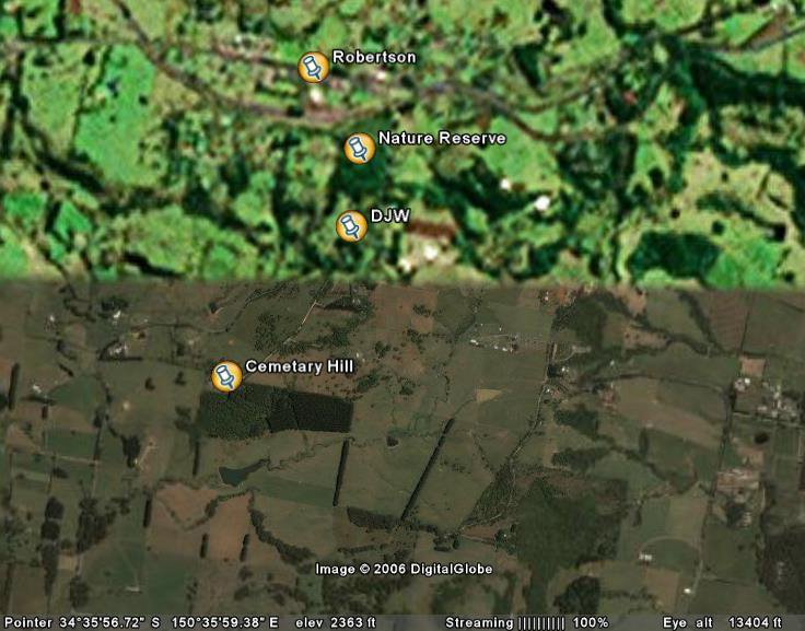 This first photo shows the village of Robertson, the Robertson Nature Reserve, a "pin" marked DJW (you can work that out) and then Cemetary Hill, which is at the end of Missingham Pde. At the Cemetary, you can clearly make out the area of forest which Hugh Waring planted about 50 years ago, which formed the rustic backdrop to the sheep-stealing scenes in "Babe". The discolouration in the bottom half of the photo is "original" from the Google Earth site. I think it shows different levels of imaging available, but I am not sure.
 The Railway Station is shown (on Google Earth) as having an elevation of about 2440 feet (743 metres). Robertson is on a line of ancient volcanic activity, which accounts for both its altitude and its soil type. The predominant soil type in the local area is red basalt. The local trees are mostly non-Eucalypt forest (cool-temperate rainforest). Because of its altitude, and proximity to the ocean, it is a high rainfall area. From 1962 onwards the mean annual rainfall has been 1616 mm (or 63.6 inches).
 In the second photo you can see the Illawarra Coastal region, with Lake Illawarra in the top right. South from there is the coastline around the Shell Harbour area. Move west, following the patches of bright green land (cleared farming land), and you will come to Robertson. So, on a clear day, (when we get one) the ocean may be seen from any high vantage point around Robertson (if you live on a ridge, and face east - I face west!). It is approximately 45 Km south-west of Wollongong and 99 Km south-west of Sydney.
 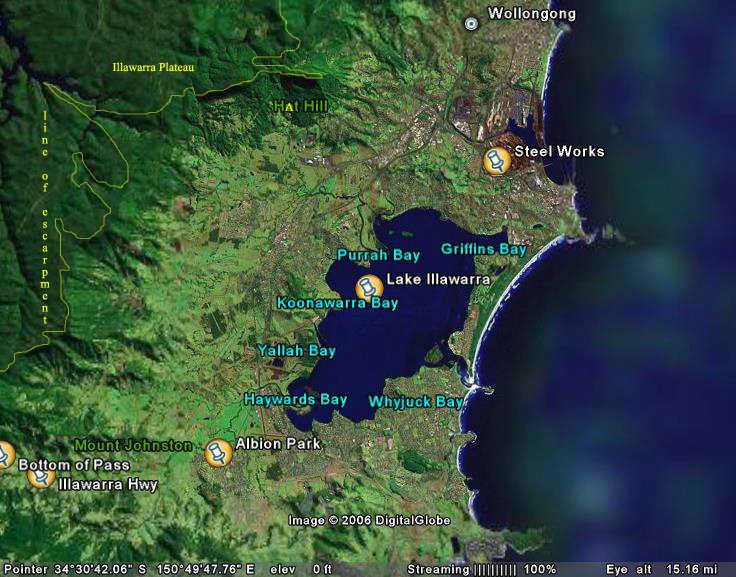 In the third image, I have sketched in (in fine yellow lines) the edge of the coastal escarpment. This escarpment line is home to a wonderful line of sub-tropical rainforests - the original forests on lower ground were cleared by the early European settlers. Beyond that (west and north) lies the area known as the Illawarra Plateau. It is a relatively flat area of sandstone, covered in dense Eucalypt forest. There are coal deposits underneath the stratas of sandstone, which accounts for the presence of the steel mills in Wollongong.
This sandstone soil area is immensely rich, from the point of view of biodiversity. It is full of native plants and birds and animals. Many of them are endemic to the region and deserve to be protected. Long may it continue to be so!
 The final image gives you the "big picture" - where we are in relation to the main sandstone plateaux surrounding Sydney. Again I have marked the full extent of the Illawarra Escarpment with a yellow line.You can see Sydney in the relatively low-lying basin. West of it is the Blue Mountains, rising to its highest point at Mount Victoria, west of Katoomba (famous for the huge gorges in the Jamison Valley and sandstone features like the "Three Sisters").
No comments:
Post a Comment